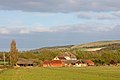
Category:Ashbury, Oxfordshire
Jump to navigation
Jump to search
village and civil parish in Vale of White Horse, Oxfordshire, England  | |||||
| Upload media | |||||
| Instance of | |||||
|---|---|---|---|---|---|
| Location | Vale of White Horse, Oxfordshire, South East England, England | ||||
| Area |
| ||||
| Different from | |||||
| official website | |||||
 | |||||
English: Ashbury is a village and civil parish in the Vale of White Horse district of Oxfordshire, England.
Subcategories
This category has the following 8 subcategories, out of 8 total.
Media in category "Ashbury, Oxfordshire"
The following 200 files are in this category, out of 328 total.
(previous page) (next page)-
 'New Road' near Compton Beauchamp - geograph.org.uk - 5872646.jpg 4,231 × 3,172; 3.02 MB
-

-
 A jogger on the d'Arcy Dalton Way, Odstone Hill - geograph.org.uk - 6010862.jpg 4,000 × 3,000; 4.55 MB
-

-
 After the shoot, Stainswick Lane - geograph.org.uk - 5182009.jpg 4,000 × 3,000; 4.85 MB
-
 Alfred's Castle - geograph.org.uk - 2206414.jpg 640 × 480; 90 KB
-
 Alfred's Castle - geograph.org.uk - 6009667.jpg 4,000 × 3,000; 4.29 MB
-
 Alfred's Castle, near Ashbury - geograph.org.uk - 1874984.jpg 1,600 × 1,200; 919 KB
-
 An erratic^ - geograph.org.uk - 1816027.jpg 3,760 × 2,475; 5.52 MB
-
 Ancient Monument - geograph.org.uk - 4907666.jpg 1,024 × 768; 199 KB
-
 Approaching Odstone Farm - geograph.org.uk - 6020462.jpg 4,000 × 3,000; 4.69 MB
-
 Arable field by Wayland's Smithy - geograph.org.uk - 3587329.jpg 1,500 × 999; 316 KB
-
 Ascending Weathercock Hill - geograph.org.uk - 1546952.jpg 640 × 426; 200 KB
-
 Ascending Wethercock Hill - geograph.org.uk - 1546958.jpg 640 × 427; 167 KB
-
 Approaching Ashbury Crossing - geograph.org.uk - 1544850.jpg 640 × 424; 72 KB
-
 Bridge at Ashbury Crossing - geograph.org.uk - 1544852.jpg 640 × 409; 59 KB
-

-
 Disused bunker - geograph.org.uk - 1175209.jpg 640 × 480; 100 KB
-
 Disused bunker - geograph.org.uk - 1175211.jpg 640 × 480; 74 KB
-
 Disused bunker - geograph.org.uk - 1175212.jpg 640 × 480; 90 KB
-
 Down the line to Swindon - geograph.org.uk - 1544847.jpg 640 × 427; 78 KB
-

-

-
 Old Milestone south of Watchfield (geograph 5622432).jpg 1,040 × 1,575; 218 KB
-
 Ruffinswick milestone.jpg 683 × 1,024; 663 KB
-
 Ashbury cottages & War Memorial.JPG 3,008 × 2,000; 2.76 MB
-
 Ashbury Crossing - geograph.org.uk - 1544853.jpg 640 × 413; 78 KB
-
 Ashbury Evangelical Free Church - geograph.org.uk - 6020443.jpg 4,000 × 3,000; 4.73 MB
-
 Ashbury Hill - geograph.org.uk - 6104229.jpg 1,880 × 1,218; 1.89 MB
-
-
 Ashbury VillageHall.JPG 2,680 × 1,880; 2.44 MB
-
 Ashbury War Memorial - geograph.org.uk - 3387839.jpg 3,000 × 4,000; 2.83 MB
-
 Ashdown Farm - geograph.org.uk - 6009985.jpg 4,000 × 3,000; 4.94 MB
-
 Ashdown Farm - geograph.org.uk - 6009996.jpg 4,000 × 3,000; 4.92 MB
-
 Ashdown Farm, Lambourn - geograph.org.uk - 1874778.jpg 1,600 × 1,200; 601 KB
-
 Ashdown Farm, near Ashdown House, Lambourn - geograph.org.uk - 1874538.jpg 1,600 × 1,200; 1.13 MB
-
 Ashdown House - geograph.org.uk - 4118798.jpg 800 × 600; 222 KB
-
 Ashdown Park Farm - geograph.org.uk - 6009980.jpg 4,000 × 3,000; 4.96 MB
-
 Ashdown park pale - geograph.org.uk - 4994318.jpg 640 × 480; 89 KB
-
 Ashdown park pale - geograph.org.uk - 4994324.jpg 4,000 × 3,000; 4.82 MB
-
 B4000 (Station Road) junction with minor road - geograph.org.uk - 3072358.jpg 3,648 × 2,736; 2.49 MB
-
 B4000 after Honeybunch Corner - geograph.org.uk - 3072328.jpg 3,648 × 2,736; 1.07 MB
-
 B4000 crosses the border - geograph.org.uk - 3071521.jpg 3,648 × 2,484; 1.18 MB
-
 B4000 descends Ashbury Hill - geograph.org.uk - 3072354.jpg 3,504 × 2,691; 2.01 MB
-
 B4000 east of Hailey Wood - geograph.org.uk - 3072323.jpg 3,648 × 2,736; 1.23 MB
-
 B4000 heading to Shrivenham - geograph.org.uk - 2209472.jpg 640 × 480; 76 KB
-
 B4000 heading to Shrivenham - geograph.org.uk - 2209487.jpg 640 × 480; 79 KB
-
 B4000 in Wheat Country - geograph.org.uk - 25990.jpg 640 × 480; 221 KB
-
 B4000 intersection with The Ridgeway - geograph.org.uk - 3072346.jpg 3,648 × 2,736; 1.43 MB
-
 B4000 passes entrance to Ashdown House - geograph.org.uk - 3071593.jpg 3,648 × 2,736; 1.21 MB
-
 B4000 passes entrance to Stainswick Farm - geograph.org.uk - 3073510.jpg 3,487 × 2,594; 1.07 MB
-
 B4000 passes pumping station - geograph.org.uk - 3071550.jpg 3,648 × 2,515; 1.79 MB
-
 B4000 passes Zulu Buildings - geograph.org.uk - 3072365.jpg 3,173 × 2,151; 1.21 MB
-
 B4000 skirts Weathercock Hill - geograph.org.uk - 3071572.jpg 3,648 × 2,736; 1.27 MB
-
 B4000 south of Zulu Farm - geograph.org.uk - 5871752.jpg 1,600 × 1,200; 652 KB
-
 Bailey Hill seen from Idstone Down - geograph.org.uk - 6013874.jpg 4,000 × 3,000; 4.86 MB
-
 Barley Crop - geograph.org.uk - 26237.jpg 640 × 480; 177 KB
-
 Barns, Ashdown Farm - geograph.org.uk - 6009987.jpg 4,000 × 3,000; 4.8 MB
-
-
 Benchmark on St Mary's, Ashbury - geograph.org.uk - 2586176.jpg 1,704 × 2,304; 1.94 MB
-
 Blocks by the Sign - geograph.org.uk - 4907682.jpg 1,024 × 768; 214 KB
-
 Blocks in the Path - geograph.org.uk - 4907655.jpg 1,024 × 768; 231 KB
-

-
 Bridleway at sunset, Knighton Down - geograph.org.uk - 6011600.jpg 4,000 × 3,000; 4.71 MB
-
 Bridleway by Odstone barn - geograph.org.uk - 2206539.jpg 640 × 480; 89 KB
-
 Bridleway near Ashbury - geograph.org.uk - 1690151.jpg 480 × 640; 225 KB
-
 Byway above Idstone - geograph.org.uk - 6009658.jpg 4,000 × 3,000; 4.61 MB
-
 Byway near Odstone Marsh - geograph.org.uk - 6020523.jpg 4,000 × 3,000; 4.67 MB
-
 Byway off the Ridgeway above Idstone - geograph.org.uk - 6009624.jpg 4,000 × 3,000; 4.78 MB
-
 Chapel Road in Ashbury - geograph.org.uk - 4126448.jpg 1,500 × 999; 166 KB
-
 Chapelwick Farm - geograph.org.uk - 4774282.jpg 3,264 × 2,448; 1.95 MB
-
 Chapelwick Farm - geograph.org.uk - 6241598.jpg 2,048 × 1,536; 674 KB
-
 Chapelwick Farm - geograph.org.uk - 6241599.jpg 2,048 × 1,536; 750 KB
-

-

-
 Compton Marsh Farm - geograph.org.uk - 3829817.jpg 1,200 × 805; 802 KB
-

-
 Copse Surrounding Wayland's Smithy - geograph.org.uk - 4911523.jpg 1,024 × 768; 265 KB
-
 Cottages, Ashdown Farm - geograph.org.uk - 6009991.jpg 4,000 × 3,000; 4.76 MB
-
 Country lane to Compton Beauchamp - geograph.org.uk - 5872645.jpg 5,009 × 3,757; 5.82 MB
-
 Cross Trees Cottage, Ashbury, Oxfordshire - geograph.org.uk - 4524175.jpg 1,600 × 1,251; 811 KB
-
 Crossing the B4000 - geograph.org.uk - 2206529.jpg 640 × 480; 81 KB
-
 D'Arcy Dalton Way near Ashbury - geograph.org.uk - 6104231.jpg 1,920 × 1,280; 1.05 MB
-
 D'Arcy Dalton Way, near Ashbury - geograph.org.uk - 3387886.jpg 4,000 × 3,000; 3.69 MB
-
 D'Arcy Dalton Way, near Ashbury - geograph.org.uk - 3387892.jpg 4,000 × 3,000; 4.29 MB
-
 Daffodils Growing - geograph.org.uk - 4911397.jpg 600 × 800; 154 KB
-
 Deer, Ashdown Farm, Lambourn - geograph.org.uk - 1874768.jpg 2,304 × 1,728; 2.4 MB
-
 Disused pit on Odstone Hill - geograph.org.uk - 3387904.jpg 4,000 × 3,000; 4.94 MB
-
 Downland between Ashbury and Lambourn - geograph.org.uk - 918575.jpg 640 × 480; 133 KB
-
 Downland between Ashbury and Lambourn - geograph.org.uk - 918576.jpg 640 × 480; 162 KB
-
 Downland between Ashbury and Lambourn - geograph.org.uk - 918577.jpg 640 × 480; 122 KB
-
 Downland between Ashbury and Lambourn - geograph.org.uk - 918580.jpg 640 × 480; 142 KB
-
 Downland between Ashbury and Lambourn - geograph.org.uk - 918581.jpg 640 × 480; 188 KB
-
 Downland between Ashbury and Lambourn - geograph.org.uk - 918639.jpg 640 × 480; 120 KB
-
 Downland track - geograph.org.uk - 1816156.jpg 3,769 × 2,480; 5.5 MB
-
 Drive to Ashdown House, Lambourn - geograph.org.uk - 3447547.jpg 640 × 480; 109 KB
-
 Drive to Odstone Farm - geograph.org.uk - 1690081.jpg 640 × 480; 144 KB
-
 Drive to Odstone Farm - geograph.org.uk - 3387915.jpg 4,000 × 3,000; 3.59 MB
-
 Drive to Stainswick Farm - geograph.org.uk - 5871635.jpg 1,600 × 800; 466 KB
-
 East façade, Ashdown House, Lambourn - geograph.org.uk - 1874540.jpg 1,600 × 1,200; 1.01 MB
-
 Elm Tree Farm at Idstone - geograph.org.uk - 3387862.jpg 4,000 × 3,000; 3.8 MB
-
 Entering Oxfordshire on the B4000 at Lambourn Corner - geograph.org.uk - 4994364.jpg 4,000 × 3,000; 4.49 MB
-
 Entrance to the Tomb - geograph.org.uk - 4907826.jpg 1,024 × 768; 258 KB
-
 Evening light, Compton Beauchamp - geograph.org.uk - 1690208.jpg 640 × 480; 138 KB
-
 Fallow field edge from The Ridgeway - geograph.org.uk - 4060966.jpg 4,608 × 3,456; 3.23 MB
-
 Farmland - geograph.org.uk - 5258708.jpg 640 × 426; 44 KB
-
 Farmland and wooded valley near Ashbury - geograph.org.uk - 3387864.jpg 4,000 × 3,000; 3.8 MB
-
 Farmland near Ashbury - geograph.org.uk - 3387869.jpg 4,000 × 3,000; 2.71 MB
-
 Farmland near Ashbury - geograph.org.uk - 3387872.jpg 4,000 × 3,000; 3.45 MB
-
 Farmland near Ashbury - geograph.org.uk - 3387935.jpg 4,000 × 3,000; 2.51 MB
-
 Farmland on the Lambourn Downs - geograph.org.uk - 918520.jpg 640 × 480; 112 KB
-
 Farmland west of Ashdown House, Lambourn - geograph.org.uk - 1874549.jpg 1,600 × 1,200; 1.16 MB
-
 Farmland, Ashbury - geograph.org.uk - 2678339.jpg 640 × 480; 171 KB
-
 Farmland, Ashbury - geograph.org.uk - 2868211.jpg 640 × 480; 164 KB
-
 Farmland, Ashbury - geograph.org.uk - 919601.jpg 640 × 480; 144 KB
-
 Farmland, Chapelwick Farm - geograph.org.uk - 5021140.jpg 640 × 327; 25 KB
-
 Field boundary at Ashbury Folly - geograph.org.uk - 3387880.jpg 4,000 × 3,000; 3.82 MB
-
 Field, Chapelwick Farm - geograph.org.uk - 5021143.jpg 640 × 426; 32 KB
-
 Fields by The Ridgeway - geograph.org.uk - 3038850.jpg 2,592 × 1,944; 1.69 MB
-
 Fields near Chapelwick Farm - geograph.org.uk - 3237645.jpg 640 × 279; 34 KB
-
 Footpath and field near Ashbury - geograph.org.uk - 3387848.jpg 4,000 × 3,000; 3.46 MB
-
 Footpath and field near Ashbury - geograph.org.uk - 3387855.jpg 4,000 × 3,000; 3.63 MB
-
 Footpath near Odstone Farm - geograph.org.uk - 3387923.jpg 4,000 × 3,000; 3.5 MB
-
 Footpath over Ashbury Hill - geograph.org.uk - 4060961.jpg 4,608 × 3,456; 3.98 MB
-
 Footpath to Ashdown House - geograph.org.uk - 4126456.jpg 1,500 × 999; 333 KB
-
 Footpath to Fern Farm - geograph.org.uk - 2208621.jpg 640 × 480; 123 KB
-
 Footpath to Hailey Wood - geograph.org.uk - 2208514.jpg 640 × 480; 85 KB
-
 Footpath to Idstone over fallow field - geograph.org.uk - 4062536.jpg 4,608 × 3,456; 3.47 MB
-
 Footpath to the Ridgeway - geograph.org.uk - 2208509.jpg 640 × 480; 95 KB
-
 Footpath to Wayland's Smithy - geograph.org.uk - 3278012.jpg 4,000 × 3,000; 3.5 MB
-
 Footpaths, Odstone Down - geograph.org.uk - 6010827.jpg 4,000 × 3,000; 4.84 MB
-
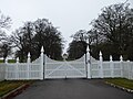 Gates to Ashdown Park - geograph.org.uk - 6009984.jpg 4,000 × 3,000; 5.07 MB
-
 Golden ball, Ashdown House, Lambourn - geograph.org.uk - 3439710.jpg 640 × 480; 76 KB
-
 Graffiti on the chimney of Ashdown House, Lambourn - geograph.org.uk - 1874907.jpg 1,600 × 1,200; 984 KB
-
 Grazing land near Compton Beauchamp - geograph.org.uk - 1690253.jpg 640 × 480; 177 KB
-
 Great Western Main Line near Compton Beauchamp - geograph.org.uk - 5872642.jpg 4,084 × 3,062; 4.02 MB
-
 High Street, Ashbury, Oxfordshire - geograph.org.uk - 4525432.jpg 1,600 × 986; 440 KB
-
 Horse in paddock at Ashbury, Oxfordshire, England.jpg 640 × 480; 115 KB
-
 House on Ashbury Hill - geograph.org.uk - 6104230.jpg 1,920 × 1,280; 1.06 MB
-
 Houses on Idstone Road, Ashbury - geograph.org.uk - 6104227.jpg 1,920 × 1,280; 1.06 MB
-

-
 Idstone Hill to the Ridgeway - geograph.org.uk - 4171761.jpg 999 × 1,500; 228 KB
-
 Idstone Road entering Ashbury - geograph.org.uk - 6104224.jpg 1,892 × 1,236; 1.25 MB
-
 Idstone Road out of Ashbury - geograph.org.uk - 4147872.jpg 1,500 × 999; 185 KB
-
 Idstone Road out of Ashbury - geograph.org.uk - 4171759.jpg 1,500 × 999; 120 KB
-
 Idstone Road, Ashbury - geograph.org.uk - 5463146.jpg 4,000 × 3,000; 4.66 MB
-

-
 Ivy covered trees in the woodland - geograph.org.uk - 3631175.jpg 1,280 × 1,920; 2.29 MB
-
 Junction of Stainswick Lane and the B 4000 - geograph.org.uk - 4774307.jpg 3,264 × 2,448; 1.96 MB
-
 Kingstone Down - geograph.org.uk - 918643.jpg 640 × 480; 151 KB
-
 Kingstone Down from the B4000 - geograph.org.uk - 3071804.jpg 3,648 × 2,736; 1.1 MB
-
 Kingstone Down from Weathercock Hill - geograph.org.uk - 6010821.jpg 4,000 × 3,000; 4.51 MB
-
 Last look at the Barrow - geograph.org.uk - 4911516.jpg 1,024 × 768; 278 KB
-
 Memorial and Thatched House, Ashbury - geograph.org.uk - 2772705.jpg 1,200 × 1,600; 438 KB
-
 Near Chapelwick Farm - geograph.org.uk - 5258710.jpg 640 × 426; 46 KB
-
 Nearing B4000 - geograph.org.uk - 2206404.jpg 640 × 480; 68 KB
-
-
 North-north-west from the roof of Ashdown House, Lambourn - geograph.org.uk - 1874906.jpg 1,600 × 1,200; 1.05 MB
-
 North-west from Western Avenue, Lambourn - geograph.org.uk - 1874559.jpg 1,600 × 1,200; 1.07 MB
-
 Notice on the Block - geograph.org.uk - 4907659.jpg 600 × 800; 130 KB
-
 Odstone Barn - geograph.org.uk - 3387882.jpg 4,000 × 3,000; 3.06 MB
-
 Odstone Coombes - geograph.org.uk - 647316.jpg 640 × 480; 177 KB
-
 Odstone Coombes - geograph.org.uk - 647318.jpg 640 × 480; 118 KB
-
 Odstone Farm - geograph.org.uk - 3387919.jpg 4,000 × 3,000; 3.73 MB
-
 Odstone Hill from D'Arcy Dalton Way, Ashbury - geograph.org.uk - 2570104.jpg 1,024 × 768; 216 KB
-
 Odstone Marsh - geograph.org.uk - 4774291.jpg 3,264 × 2,448; 1.95 MB
-
 Odstone Marsh - geograph.org.uk - 6020528.jpg 4,000 × 3,000; 4.44 MB
-
 Old agricultural equipment near Ashbury - geograph.org.uk - 3387853.jpg 4,000 × 3,000; 4.71 MB
-
 Over the line to Idstone - geograph.org.uk - 4171774.jpg 1,500 × 999; 149 KB
-
 Over the top - geograph.org.uk - 4911389.jpg 1,024 × 768; 288 KB
-
 Paddocks at Ashdown Farm - geograph.org.uk - 3038836.jpg 2,592 × 1,944; 1.62 MB
-
 Palmer sites 2011 Ashbury 032.jpg 2,628 × 1,780; 2.17 MB
-
 Panoramic view from D'Arcy Dalton Way, Ashbury - geograph.org.uk - 2570077.jpg 7,017 × 1,978; 3.83 MB
-
 Panoramic view from the roof of Ashdown House, Lambourn - geograph.org.uk - 1878569.jpg 8,639 × 1,578; 2.2 MB
-

-
 Pastures, Ashbury - geograph.org.uk - 647309.jpg 640 × 480; 106 KB
-
 Path crossing - geograph.org.uk - 1816085.jpg 3,751 × 2,471; 4.17 MB
-
 Path crossing - geograph.org.uk - 1816111.jpg 3,774 × 2,480; 4.2 MB
-
 Path towards Wayland's Smithy from the Ridgeway - geograph.org.uk - 6059981.jpg 1,600 × 900; 492 KB
-
 Pitted stone on Wayland's Smithy - geograph.org.uk - 3587338.jpg 1,500 × 999; 330 KB
-
 Pond near Odstone Farm - geograph.org.uk - 3387929.jpg 4,000 × 3,000; 4.23 MB
-
 Pond near Odstone Farm - geograph.org.uk - 6020466.jpg 4,000 × 3,000; 4.52 MB
-
 Pound Piece, Ashbury - geograph.org.uk - 5871761.jpg 1,600 × 1,200; 650 KB
-
 Public bridleway near Compton Beauchamp - geograph.org.uk - 6020509.jpg 4,000 × 3,000; 4.72 MB
-
 Public bridleway near Odstone Farm - geograph.org.uk - 6020470.jpg 4,000 × 3,000; 4.66 MB
-
 Restricted Byway - geograph.org.uk - 2208517.jpg 640 × 480; 101 KB
-
 Restricted Byway - geograph.org.uk - 2208520.jpg 640 × 480; 82 KB
-
 Ridgeway junction, D'arcy Dalton Way going south - geograph.org.uk - 4060896.jpg 4,608 × 3,456; 4.32 MB
-
 Ridgeway past Wayland Smithy - geograph.org.uk - 4907669.jpg 1,024 × 768; 255 KB
-
 Rose Cottage, Chapel Road, Ashbury - geograph.org.uk - 5463143.jpg 4,000 × 3,000; 4.83 MB
-
 Ruffinswick Farm - geograph.org.uk - 4774289.jpg 3,264 × 2,448; 1.94 MB
-
 Ruffinswick Farm - geograph.org.uk - 5021152.jpg 640 × 426; 32 KB
-
 Ruffinswick Farm - geograph.org.uk - 5021155.jpg 640 × 426; 33 KB
-
 Sarsen stones at entrance to Ashdown Park - geograph.org.uk - 6010002.jpg 4,000 × 3,000; 4.76 MB
-
 Sarsen Stones in the Afternoon - geograph.org.uk - 2774340.jpg 640 × 480; 62 KB
-
 Sarsens Beside The Road - geograph.org.uk - 3299257.jpg 1,024 × 691; 147 KB
-
 Signs on the Ridgeway - geograph.org.uk - 6010836.jpg 4,000 × 3,000; 5.06 MB
-
 Snivelling Corner - geograph.org.uk - 6020340.jpg 4,000 × 3,000; 5.02 MB
-
 Snowdrops at the Smithy - geograph.org.uk - 4911512.jpg 1,024 × 768; 282 KB
-
 South-east from Western Avenue, Lambourn - geograph.org.uk - 1874762.jpg 1,600 × 1,200; 1.2 MB


_-_geograph.org.uk_-_362085.jpg)
_-_geograph.org.uk_-_362093.jpg)
.jpg)


_junction_with_minor_road_-_geograph.org.uk_-_3072358.jpg)


